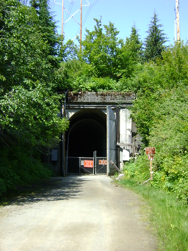
On July 5, 2011, the Snoqualmie Tunnel was re-opened after completion of a significant repair project. This tunnel is part of the John Wayne Pioneer Trail in Iron Horse State Park just east of Seattle, WA. It was closed in 2009 (actually didn't reopen after the '08-'09 winter closure) due to safety concerns (falling rocks and an underground RIVER flowing through it). The tunnel was fenced off with big warning signs advising you not to enter...
 Snoqualmie Tunnel east entrance, Snoqualmie Pass, WA, as it looked in 2009-2011 during the safety closure.
This tunnel has been on my "bucket ride" list ever since I heard of it when I first moved back to WA in 2001. I never made it up there until they closed it. Then the economic downturn and state budget cuts made it seem like they would never get it fixed. I heard about the opening several days after it happened (I was out of town on vacation at the time) and was pleasantly surprised.
Trail surface: gravel, packed gravel, and packed dirt.
Bike recommendations: anything with tires wider than 28mm (i.e. don't ride on a road bike with skinny tires). Cyclocross bikes should be fine. The last time I rode I was on a bike with 26" x 1.7" road tires and they worked great.
The WA State Park Service has contracted with a private company to provide a shuttle from the trailhead, near Cedar Falls and Rattlesnake Lake, all the way up to the summit at Hyak. This allows you to park your car and, for somewhere around $20, you and your bike can be shuttled up to the top and ride the ~23 miles downhill back to your vehicle. Total time, including shuttle ride, should be in the neighborhood of 3 hours.
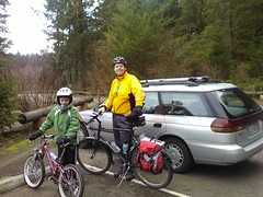
I fully intended to ride through the tunnel with 2 of my kids (the 2 that can ride) leaving the other home with Mom but when Saturday arrived Mom was sick in bed. Change of plans! Our ride down the trail turned into a hike through the tunnel with some geocaching thrown in for good measure.
We started out playing the compass game...
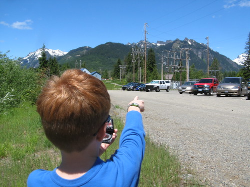 Playing the compass game at Snoqualmie Pass, WA
To play the compass game you simply find an object in the distance, using your compass to get the magnetic bearing. Then you have someone else stand in the exact same spot (very important!) and try to determine which object you were pointing at using only the compass bearing. My kids love to try to stump Dad but I always get it. }B^)
We ate some lunch and read the information signs at the Hyak parking lot along the trail.
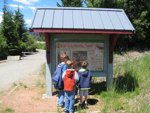 Informational board at the Hyak parking lot, Iron Horse State Park, WA
And then we hiked the very short distance (less than 1/3 of a mile) to the tunnel entrance. This is the east entrance of the Snoqualmie Tunnel.
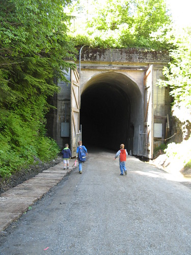 East entrance of the Snoqualmie Tunnel, Iron Horse State Park, WA
Inside the tunnel we hiked for about half a mile before we turned back. My boys were not in the mood to hike the nearly 2.5 miles to the west entrance on the other side of Mt. Catherine. So we hiked in a bit, found a geocache, and called it a day.
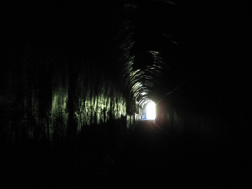 Looking out toward the east entrance, Snoqualmie Tunnel, Iron Horse State Park, WA
So the tunnel is open ready for riders. The trail in the tunnel was very smooth but a bit moist. There are a few dripping leaks from the roof (expected in a 100+ year old tunnel) but the eastern 1/3 of the tunnel is virtually brand new trail surface and walls/ceiling. I'll be back again this summer with my boys to ride the tunnel and trail again.
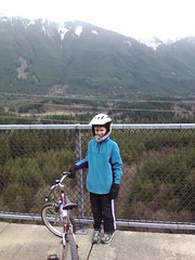
Our next stop was a great little lake called "Gold Creek Pond", a reclaimed gravel pit right across the freeway from Hyak on I-90. This is a very picturesque lake with picnic tables, a paved trail around the perimeter, and great views of the mountains. We intended to ride our bikes on the perimeter trail but USFS rules stated "no bikes" so we ended up walking.
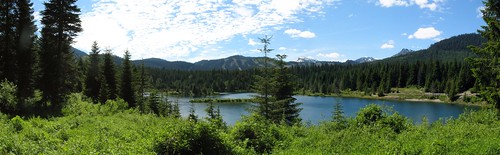 Gold Creek Pond near Snoqualmie Pass, WA
If you are looking for a quick picnic at Snoqualmie Pass this is a great place. The trail was flat and easy, the picnic tables are 100 yards from the parking lot, and there weren't many people around.
To make up for the fact that we didn't get to ride in the tunnel or around the pond our next and final stop was the Marymoor Velodrome, Marymoor Park in Redmond, WA. This is one of my boys' favorite places to ride, and for good reason-
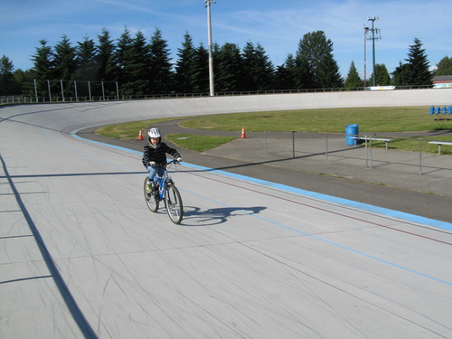 Marymoor Velodrome, Marymoor Park, Redmond, WA
The track itself is open to the public (when not in use for classes or races). The surface is textured concrete with banked turns and a 400m circumference. This is one of the few outdoor bike tracks in the western US and it is just a few miles from my house! I highly recommend checking it out and taking a few laps.
As I was playing around on the track with my oldest son I broke the frame on one of my favorite bikes, my nearly 18 year old Schwinn High Plains. After nearly 10,000 miles it finally gave out under my weight. I can generate a lot of torque and have replaced many parts on this bike over the years. It's like losing an old friend. Yes, I almost cried.
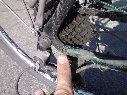 Broken rear dropout, drive side on the rear wheel of my 1993 Schwinn High Plains after nearly 10,000 miles. Goodbye old friend!
...but then I remembered something very important: NOW I CAN GO BIKE SHOPPING! In the past 3 years this bike has served as my year-round commuter bike and has seen everything from thunderstorms, sleet, and hail (which really hurts your face). Now I need another bike that can fill this void.
Upcoming posts: shopping updates!